Categories
Environment India News

India to receive normal, well distributed rainfall: IMD

The LPA of the season rainfall over the country as a whole for the period 1961-2010 is 88 cm…reports Asian Lite News.

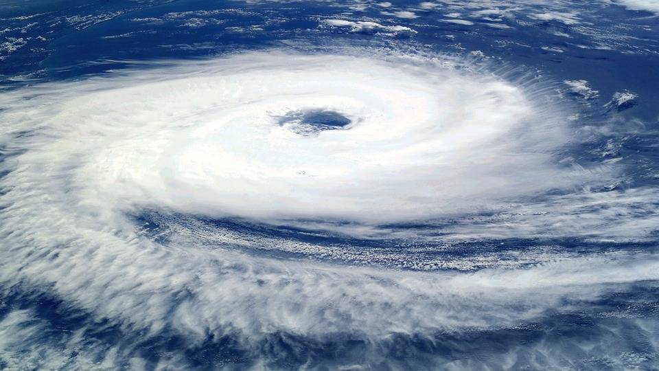
Southwest monsoon’s seasonal rainfall from June to September this year over the country, as a whole, is most likely to be normal and well-distributed spatially, according to the India Meteorological Department (IMD).

The rainfall during these four months is expected to be 96 to 104 per cent of the Long Period Average (LPA).

However, the IMD’s National Weather Forecasting Centre said, quantitatively, the monsoon seasonal rainfall during these four months over the country as a whole is likely to be 101 per cent of the LPA with a model error of four per cent up or down.

The LPA of the season rainfall over the country as a whole for the period 1961-2010 is 88 cm.

Rain. (File Photo: IANS)

“Monsoon seasonal rainfall is likely to be well distributed spatially and most parts of the country is expected to receive normal to above normal rainfall during the season,” said the IMD.

The latest global model forecasts indicate the prevailing neutral ENSO (El Nino Southern Oscillation) conditions are likely to continue over the equatorial Pacific Ocean and possibility of development of negative IOD conditions over the Indian Ocean during the monsoon season, it said.

The weather office further said the southwest monsoon seasonal (June to September) rainfall over the four homogeneous rainfall areas is most likely to be normal over northwest India from 92-108 per cent and south peninsula from 93-107 percent. It is most likely to be below normal over northeast India (106 per cent).”

The southwest monsoon seasonal (June to September) rainfall over the monsoon core zone, which consists of most of the rainfed agriculture regions in the country is most likely to be above normal (over 106 per cent of LPA), it said.

ALSO READ-EU reaches deal on first climate law

READ MORE-‘Climate change is an existential risk’

Categories
-Top News Kerala

Cyclon Tauktae: Heavy wind, rain cause damage in Kerala

Tauktae is very likely to intensify further into a severe cyclonic storm during the next 24 hours and expected to move north-north-westwards and reach near the Gujarat coast by May 18 morning, reports Asian Lite News

 The after effects of the deep depression formed over Lakshadweep in the Arabian Sea that intensified into a cyclonic storm (Tauktae) over the archipelago and adjoining southeast east central Arabian Sea moving northwards during the past six hours, has caused huge damage to the coastal areas in Kerala.

Even though the depression is approximately around 290 km away from Kannur, on account of the heavy rains across the state, and with the sea turning rough, the state government has been forced to open numerous camps across the state to move people to safety.

According to the India Meteorological Department Tauktae is very likely to intensify further into a severe cyclonic storm during the next 24 hours and expected to move north-north-westwards and reach near the Gujarat coast by May 18 morning.

Kerala Chief Minister Pinarayi Vijayan

Kerala Chief Minister Pinarayi Vijayan has informed the preparedness of the state in facing any calamity arising out of the cyclonic storm.

“Even though, Kerala is not in the predicted path of the cyclone, heavy rains, strong winds and strong sea gusts are expected in the State till May 16. We should exercise utmost caution in districts and adjoining districts where the Meteorological Department has issued a Red and Orange Alert,” said Vijayan and appealed to all to cooperate with the authorities and move out to camps whenever told.

Even though so far there has been no casualties reported, the rain and the rough sea has caused innumerable hardships to the people, who are already battling the Covid pandemic.

The worst affected on account of the rough sea include the coastal hamlets in the state capital, parts of Kollam, Alappuzha, Ernakulam, Thrissur, Malappuram, Kozhikode, Kannur and Kasargode.

Tauktae

Starting Friday night, huge number of trees were uprooted and power supply disrupted for long hours on account of the high speed winds and heavy rain. In many places the supply was restored on Saturday, while in few places it’s yet to be restored.

With the state under a total lockdown from May 8, the only saving grace was the police did not have much work to man people on the roads.