Categories
-Top News UK News

Heavy Rainfall Prompts Flood Warnings Across UK

Low-pressure systems are expected to bring wet and windy conditions, displacing recent cold weather with frosts and snow…reports Asian Lite News

The UK is facing weather warnings and an increased risk of flooding as forecasters caution about heavy rainfall and potential travel disruptions.

Over 20 flood warnings are in effect in western England, with the Met Office anticipating up to 80mm of rain in certain areas.

The concern is compounded by saturated ground and melting snow, heightening the flood risk. Neil Armstrong, Chief Forecaster at the Met Office, issued severe weather warnings for rain across the UK, particularly in the west and eastern Scotland, where up to 100mm of rain could accumulate.

The warnings cover southwest England, the Midlands, northern England, Scotland, most of Northern Ireland, and south Wales until Thursday evening.

Low-pressure systems are expected to bring wet and windy conditions, displacing recent cold weather with frosts and snow.

A second low-pressure system will bring additional weather fronts on Friday and Saturday morning. The RAC motoring group advised caution on flooded roads, urging drivers to avoid risking safety and expensive repairs.

As the weather unfolds, a brief calmer spell is anticipated in the southern UK on Saturday afternoon, though showery rain will persist in the north, according to the Met Office.

ALSO READ-Hurricane Hilary enters amid earthquake; heavy rainfall

Categories
Environment India News

Heavy rainfall lashes parts of Mumbai, 2 killed

The BMC Disaster Control reported 22 instances of tree crashes, including two with fatalities (as above), 4 complaints of short-circuits, and six minor house-crashes in the city…reports Asian Lite News

At least two persons were killed in rain-related incidents as Mumbai and surrounding districts were clobbered with torrential rains since Tuesday night, even as the road, rail and air traffic were largely unaffected, officials said on Wednesday.

According to Mumbai Police, a 38-year-old man Kaushal Doshi was killed when a massive tree crashed on him at Mamledarwadi in Malad west.

Another tree collapse was reported at Mithanagar in Goregaon west and 30-year-old Premlal Nirmal was killed, it said.

In a shocker, a landslide occurred on a portion of the road near the Mumbai Metro Magathane station, near Borivali, causing minor damage but there were no casualties.

The Western Railway, Central Railway and the Harbour Lines functioned normally despite heavy rains and reported no water logging on the train tracks on the entire suburban sections, officials said.

According to the IMD, Mumbai city and suburbs notched a total of 77 mm rains each till 6 p.m. on Wednesday.

The BMC’s weather stations have recorded 32 mm in the city, 84 mm in eastern suburbs and 83 mm in the western suburbs till 6 p.m.

The incessant downpour resulted in waterlogging in many low-lying areas of the city and suburbs, ranging from ankle-deep to knee deep water, leading to massive traffic snarls reported across Mumbai.

The BMC Disaster Control reported 22 instances of tree crashes, including two with fatalities (as above), 4 complaints of short-circuits, and six minor house-crashes in the city.

A 17-year-old youth Rehan Shaikh was injured in a house wall collapse in Govandi and has been admitted to the Shatabdi Hospital. In Vikhroli, the BMC and police evacuated over two dozen slumdwellers after a landslide and mudslide due to the downpour and they shifted to their relatives’ homes though a private school was kept ready to house them.

Facing flak from various quarters, the BrihanMumbai Municipal Corporation (BMC) teams swung into action to clear the water but their efforts were hampered by the high tide in the Arabian Sea this evening at 7 p.m. with waves reaching 3.48 metres that pushed back the drainage water.

Sporting an orange raincoat, BMC Commissioner Dr. I.S. Chahal and his team of officials stepped into the field for a spot assessment of the rainfall situation in several areas, including a portion of the Mithi River, the pumping station at Hindmata and underground water storage tanks.

The downpour notwithstanding, the BMC has announced a 10 per cent water cut in the city from July 1, while Navi Mumbai will be slapped with a 15 per cent water cuts, said officials.

A compound wall crash in an NRI complex in Navi Mumbai flattened around a dozen vehicles parked besides, including some high-end cars, and the rescue officials were deployed for the clearing operations.

Large areas of Thane city – the hometown of Chief Minister Eknath Shinde, Badlapur, Bhiwandi, Kalyan, Dombivali and other towns – witnessed heavy rains with flooding in low-lying areas. The police, fire brigade, disaster teams and home guards were kept in readiness for quick deployment in any emergency as rains continue to pound Mumbai and surrounding districts.

The IMD has sounded rainfall alerts of varying degrees for Mumbai, Thane, Palghar, Raigad, Ratnagiri, Sindhudurg in the coastal Konkan region over the next three days.

ALSO READ-Lulu Group all set to enter Telangana 

Categories
India News Lite Blogs

Troubles mount for residents of Kosi riverbanks  

When the volume of water is low, the pace of its flow increases and causes rapid erosion of the sandy soil…reports Asian Lite News

Monsoon in Bihar is a bundle of paradoxes. While water-induced soil erosion usurps houses in districts with no rains, heavy downpour and resultant floods wreak havoc in other parts of the state. River Kosi, aptly called the ‘Sorrow of Bihar’, is the central character in this vicious weather cycle.

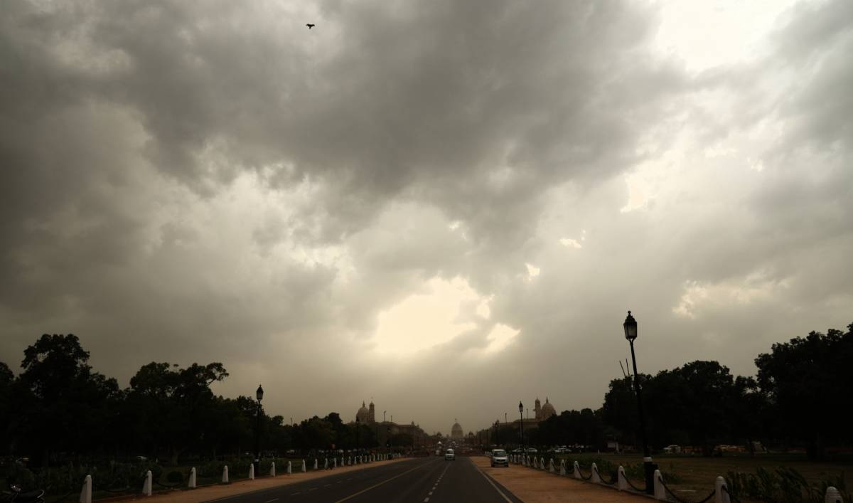
This year, monsoon rains have failed in most parts of the state, with only Araria and Kishanganj districts registering above-normal rainfall. On an average, the state recorded 86 per cent less rainfall in July, which normally is the time of heavy downpour.

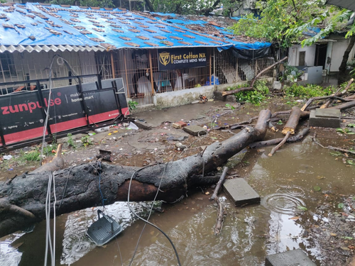
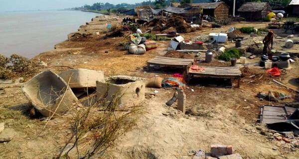
Yet, there is no respite from flood-like conditions in areas where it has not rained much. Over 100 houses have been razed since last month in Bela Goth village in Supaul district’s Kishanpur block, as the Kosi’s currents breached embankments. It’s the same situation in Khai Tola and Musaldanga in Nisndara panchayat, Kishanganj district’s Bahadurganj block. Kaharpur and Rangra in Bhagalpur district are equally devastated. In Purnia district’s Amour block, the Parman has breached its banks and entered several homes.

“In the Kosi, erosion increases when the water level is low. It also gets really fast at both the beginning and waning phases of the floods,” says Dr Dinesh Chandra Mishra, an IIT-Kharagpur alumnus who has conducted extensive research on the Kosi and penned several books on the subject.

Charting a new course

Why does the Kosi cause devastating erosion and floods that leave thousands of people homeless? The answer lies in the river’s changing course. A tributary of the Ganga, the Kosi flows in higher altitudes, cutting through the Himalayas. By the time it reaches the low-gradient plains of Bihar, millions of tonnes of silt get deposited in the river. Over the years, as the height of the river bed rose due to silt deposition, the Kosi began to chart new routes.

The river does seem to have a mind of its own! It has a general tendency to change its course in the western direction. When the volume of water is low, the pace of its flow increases and causes rapid erosion of the sandy soil.

Furthermore, the frequent change in the river’s course has changed the soil composition, making the areas along its banks highly prone to erosion. It is estimated that in the past 200 years, the Kosi has changed its direction from east to west in a stretch of 133km.

This one’s perhaps the most unpredictable river in the world. It flowed near Forbesganj and Purnia in 1731, but entered Murliganj by 1892. Again, in 1922, the river charted a new course through Madhepura. In 1936, it began to flow through Saharsa and Darbhanga.

Such deviations from its natural path lead to flooding of residential and agricultural areas, always making the lives of thousands of people miserable. To tame the river, embankments were constructed along its path, which led to silt deposition in the same course all the time. This, in turn, increased the pressure of breach on embankments. By design, such constructions also made it impossible for water from other places to drain into the Kosi.

It’s raining misery

“If measures to prevent erosion are not taken in time, at least 500 families will be rendered homeless,” warns Chandrashekhar, the founder of Gramyasheel, an NGO working for the development of villages along the Kosi embankments.

“Apart from Bela Goth, erosion has intensified in Khokhna Mana Toll, Mozha panchayat and Dubiyahi in Ghogharia panchayat, Kishanpur block. During the floods last year, our team had cited the looming threat of erosion and demanded that measures be taken to prevent it, but in vain,” claims Chandrashekhar, whose NGO was instrumental in relief work during the 2008 Kusaha floods.

Sulochana Devi of Bela Goth blames the state government for the murky situation they were in.

“Only 10 to 12 families have been allotted resettlement land. The rest live in makeshift houses built on roadsides. Initially, authorities provided dry food items. But now, nobody even visits us,” the 37-year-old said.

All the while, the only word of caution from the State Disaster Management Department was in the form of a tweet on June 24, where it listed out measures to protect rural areas from floods. No data on erosion and floods were made available, and it is hardly surprising when considering the fact that the department had, last year, provided the official figures of the flood-affected when the topic had become obsolete for the media.

Farmers hit hard

“It’s monsoon season, yet the fields have developed cracks. Rice plants have turned yellow. We are at the mercy of gods now,” rues Guddu Choudhary of Veena panchayat, where special community pujas for rains were conducted recently.

Bihar is a major producer of paddy, where about 76 per cent of the population is dependent on agriculture. Of its total 79.46 lakh hectares of arable land, rice is cultivated in about 32 lakh hectares, i.e. more than 40 per cent. The state produces about 80 lakh tonnes of paddy annually.

Heat and humidity have taken their toll on the paddy transplantation process. According to Bihar Agriculture Department Secretary N Saravana Kumar, only 15 per cent to 20 per cent planting could be completed in the state so far.

Moreover, the lack of irrigation facilities has compounded the issue.

“Ideally, paddy transplantation should have been completed by now, but fields situated in the upper grounds are not yet covered,” says 38-year-old Mukesh Jha of Chakrami panchayat in Bhagalpur. “In the low-lying areas, pump sets are aiding in the process. When planting is delayed, the crop quality and yield gets affected. Last time, urea shortage hit us hard. We don’t know when Mahadev will show some mercy.”

Ponds and micro-catchment systems along the fields have also dried up in many places. Bablu Paswan, a 54-year-old who has cultivated paddy in seven bighas of land in the same village, says: “The water level has dropped considerably. In some villages, tubewells have dried up. Power supply from the agriculture feeder is also down. Though borewells have been installed under a government scheme, lack of maintenance has rendered them useless.”

Experts speak

Shankar Jha, a scientist at the Dr Rajendra Prasad Central Agricultural University at Pusa in Samastipur, says climate change has greatly impacted monsoons in Bihar.

“Where it used to rain for 55 to 60 days some five years ago, it rains only for 45 days now. This is what our university’s study report revealed,” he adds.

Another agricultural scientist, Anil Jha says the air quickly absorbs the moisture from the Bay of Bengal. This, along with winds from the east and west, lead to turf formation that triggers rains in the surrounding area.

“As that has not happened so far, the agricultural sector is suffering. If farmers have to stay ahead of the game, they should not shy away from climate-resilient crop diversification,” he stresses.

ALSO READ-Karnataka to expand cabinet by Aug first week

Categories
Environment India News

Heavy rainfall to continue in Western India

The monsoon trough is active and south of its normal position, the India Meteorological Department (IMD) said…reports Asian Lite News

With the monsoon trough active and continuing to be at a position south of its normal, very heavy to extremely heavy rainfall is likely over Gujarat, the Western Ghat areas of Maharashtra, Konkan, and Goa on Thursday and over Saurashtra and Kutch till Friday.

“A well-marked Low Pressure Area lies over south coastal Odisha and neighbourhood with the associated cyclonic circulation extending up to upper tropospheric levels tilting southwestwards with height. The monsoon trough is active and south of its normal position,” the India Meteorological Department (IMD) bulletin on Wednesday.

An east-west shear zone runs roughly along 20 degree North in middle and upper tropospheric levels tilting southwestwards with height across north peninsular India, the IMD said.

“Under the influence above two systems, fairly widespread/widespread light/moderate rainfall and thunderstorm/lightning with isolated heavy rainfall is very likely over Chhattisgarh, Vidarbha, Madhya Pradesh, Odisha, Maharashtra, Gujarat, Kerala, and Mahe, coastal Andhra Pradesh and Yanam, Telangana, and Karnataka during next 5 days.”

Isolated very heavy rainfall is very likely over west Madhya Pradesh and Telangana on Thursday, east Madhya Pradesh on Sunday, Vidarbha on Thursday and Sunday, Chhattisgarh over the weekend, Odisha till Saturday, Konkan and Goa, central Maharashtra and Gujarat region on Friday, Saurashtra and Kutch on Saturday, and coastal and south interior Karnataka on Thursday.

Isolated heavy to very rainfall with extremely heavy rainfall is very likely over Gujarat, the Ghat areas of Maharashtra, Konkan, and Goa on Thursday and over Saurashtra and Kutch till Friday.

Stating that scattered to fairly widespread light/moderate rainfall with isolated thunderstorm/lightning is very likely over Jammu, Kashmir, Ladakh, Gilgit, Baltistan and Muzaffarabad, Himachal Pradesh and Uttarakhand during next five days and over Punjab, Haryana, Chandigarh, Delhi & Rajasthan during next three days, the IMD bulletin said, adding that there will be reduction thereafter.

Flood situation in Telangana

Telangana Chief Minister K Chandrashekhar Rao has put the state administration, Ministers, MLAs on alert as heavy rains lashed the state.

The Chief Minister held marathon reviews with every department and issued necessary instructions to contain flood-related damages.

KCR is in constant touch with the administration in flood-affected areas of the Godavari River basin. He spoke to Ministers A Indrakaran Reddy, P Ajay Kumar and V Prashanath Reddy and enquired about the flood situation in the heavy rain-hit districts.

On CM instructions, Ministers, MLAs and Officials are shifting people from flood-affected areas to safer zones. Regular monitoring helped to keep control of the flood losses, said the government.

As the flood water is flowing heavily into the Kadem project, the authorities have evacuated the people of 12 villages that are being flooded due to the release of water downstream of the Kadem project.

The Chief Minister ordered the local minister Indrakaran Reddy over the phone to take protective measures from there.

The Chief Minister directed Special Chief Secretary Municipal Department Arvind Kumar to take immediate action in the river catchment area towns which are facing floods including Nirmal.

The CM ordered Minister Vemula Prashant Reddy to take immediate steps to restore the national and state roads which are cut off due to floods.

The CM directed the CS, Irrigation Officers, District Collectors and SPs to take immediate measures to prevent any loss of life.

ALSO READ-Flood fury in MP: Highway closed, flights diverted

Categories
Environment and WIldlife

‘SW monsoon rainfall to be normal this year’

That explains the quantitative forecast of 99 per cent plus/minus 5 per cent of model error…reports Asian Lite News

In what can bring cheer to large parts of agrarian India, the south-west monsoon rainfall this year, over the country as a whole, is most likely to be normal – quantitatively 99 per cent of the Long Period Average (LPA), the India Meteorological Department (IMD) said on Thursday.

The IMD also announced a slight reduction in the new normal for all India rainfall based on decadal data.

The LPA rainfall for the June to September period over the country as a whole for the period 1971-2020 is 87 cm. This 87 cm is the new normal all India rainfall from this year that the IMD has introduced replacing the earlier 88 cm based on 1961-2010 data.

“Normal to above normal seasonal rainfall most likely over many areas of northern peninsula and central India, along foothills of the Himalayas and some parts of northwest India, below normal rainfall is likely over many parts of northeast India, some parts of northwest India and southern parts of the south Peninsula,” IMD Director General, Meteorology, Mrutyunjay Mohapatra told media persons.

That explains the quantitative forecast of 99 per cent plus/minus 5 per cent of model error.

The IMD would also provide forecasts for the monsoon convergence zone (MCZ), majorly central Indian portion, extending from Gujarat and Rajasthan to Odisha, which is largely rain-fed area (for agriculture) and therefore from last year, making IMD’s specific MCZ forecast more relevant for the farmers.

On the change of new normal rainfall for the whole of India from 88 cm to 87 cm, Mohapatra said: “This decrease is part of natural multi-decadal epochal variability of dry and wet epochs of all India rainfall. Presently it is a dry epoch, which started in the decade 1971-80. The decadal average of all India SW monsoon rainfall for the decade 2011-20 is (-) 3.8 per cent from the long-term mean. The next decade i.e. 2021-30 will come close to neutral and will likely to enter in the wet epoch from the decade 2031-40.”

A cause of worry, if at all, is the likely presence of negative Indian Ocean Diapole (IOD) – the difference in warming/cooling of the west Indian Ocean and the east Indian Ocean – around the time of beginning of the southwest monsoon season even when, at present, there is neutral IOD conditions over the Indian Ocean, Mohapatra said, adding: “However, we have to wait and watch how the situation pans out by then.”

La Nina conditions prevail over the equatorial Pacific region and are likely to continue during the monsoon season. La Nina is associated with the cooling over the central and east Pacific Ocean. An El Nino (as against La Nina) is generally associated with deficient (surplus) monsoon rainfall over India. However, there is no one to one relationship between El Nino and the Indian monsoon.

ALSO READ-Indian scientists reveal new layer of monsoon circulation’s link to Antarctica

Categories
Environment India News

North India likely to witness intense rainfall July 18-21: IMD

According to the Met department, isolated extreme heavy rainfall is also very likely over Uttarakhand between July 18 and July 19….reports Asian Lite News

Northern India is likely to witness intense rainfall activity between Sunday to Wednesday (July 21), and the west coast till July 23, the India Meteorological Department (IMD) forecast on Sunday.

It has also predicted moderate to severe thunderstorms with lightning at isolated places over Uttar Pradesh, Gujarat, Madhya Pradesh, and east Rajasthan during the next 24 hours, and warned of casualties to people and animals staying outdoors.

“Rainfall activity is very likely to increase with widespread rainfall to isolated heavy to very heavy rains very likely over the western Himalayan region (Jammu, Kashmir, Ladakh, Gilgit, Baltistan and Muzaffarabad, Himachal Pradesh and Uttarakhand) and adjoining northwest India — Punjab, Haryana, Rajasthan, UP and north Madhya Pradesh — from July 18 to 21,” the IMD said in a statement.

However, there will be a decrease in rainfall activity over the same regions thereafter, it said.

According to the Met department, isolated extreme heavy rainfall is also very likely over Uttarakhand between July 18 and July 19.

Delhi is likely to witness moderate to heavy rainfall, it said.

Isolated heavy rainfall is likely over east and adjoining central India from July 22 onwards.

ALSO READ: India fast tracks ties with Tajikistan as China-Pak go all out